Unveiling the True Size of Africa: The Distortion of the Mercator Map
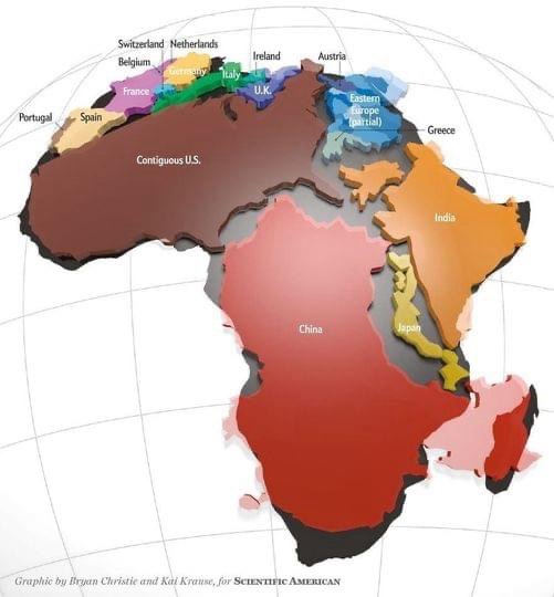
A stylized world map graphic showing the contiguous United States as a large landmass, with China, Japan, India, and parts of Europe (including Greece, Eastern Europe, and the U.K.) overlaid on or adjacent to it. The map uses distinct colors for each region and includes labels for countries and areas. The image is credited to Bryan Christie and Kal Krause for Scientific American. The overlaid text labels the various regions as shown.
0
0
0
0
2025-06-25 12:00:03
See More Related Memes

Loading...
Comments
No comments yet. Be the first to comment!