Crucial Information You Need to Know
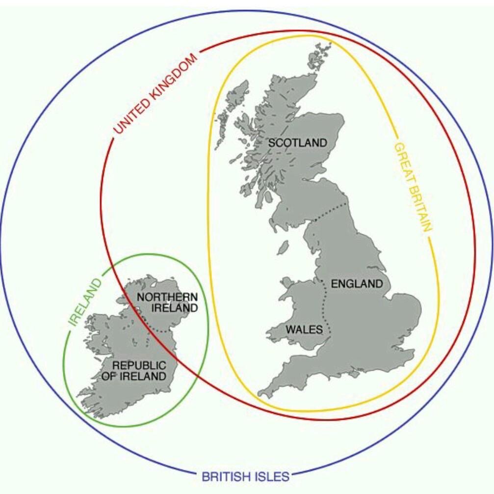
A diagram showing overlapping circles labeled 'UNITED KINGDOM', 'GREAT BRITAIN', 'IRELAND', and 'BRITISH ISLES' around maps of Scotland, England, Wales, Northern Ireland, and the Republic of Ireland. The text labels are written along the curved lines of the circles. The image visually represents the complex political geography of the British Isles, with Great Britain (England, Scotland, Wales) inside the United Kingdom, and Northern Ireland also part of the UK, while the Republic of Ireland is separate. The entire group is labeled 'BRITISH ISLES'.
0
0
0
0
2025-03-04 05:23:11
See More Related Memes
Loading...
Comments
No comments yet. Be the first to comment!